


You may also like
-
Spain & Portugal Poster
Bartholomew John George · 1922 · Detailed Iberian Peninsula map poster with coastal outlines, borders, and classic atlas typography
Poster from 102 kr · Framed from 181.33 kr
Regular price From 68.00 krRegular price -
Hispania Poster
Heinrich Kiepert · 1850 · Detailed map poster of Roman Hispania with colored provinces and fine place names
Poster from 102 kr · Framed from 181.33 kr
Regular price From 68.00 krRegular price -
Antique map of Mexico Poster
Institute of Liepzig · 1887 · Detailed Mexico vintage print featuring crisp borders and classic atlas typography
Poster from 102 kr · Framed from 181.33 kr
Regular price From 68.00 krRegular price -
Antique map of Italy Poster
Institute of Liepzig · 1887 · Classic Italy map poster with crisp borders, islands, and dense geographic labeling
Poster from 102 kr · Framed from 181.33 kr
Regular price From 68.00 krRegular price


-

"Very nice Posters. The quality is amazing and we received it very quickly !"
-

"A shop to visit absolutely. Huge selection of posters. We spent more than an hour there !"
-

"Perfect to find gift. Price are very good. An they can frame and pack it on site"


About the Artist
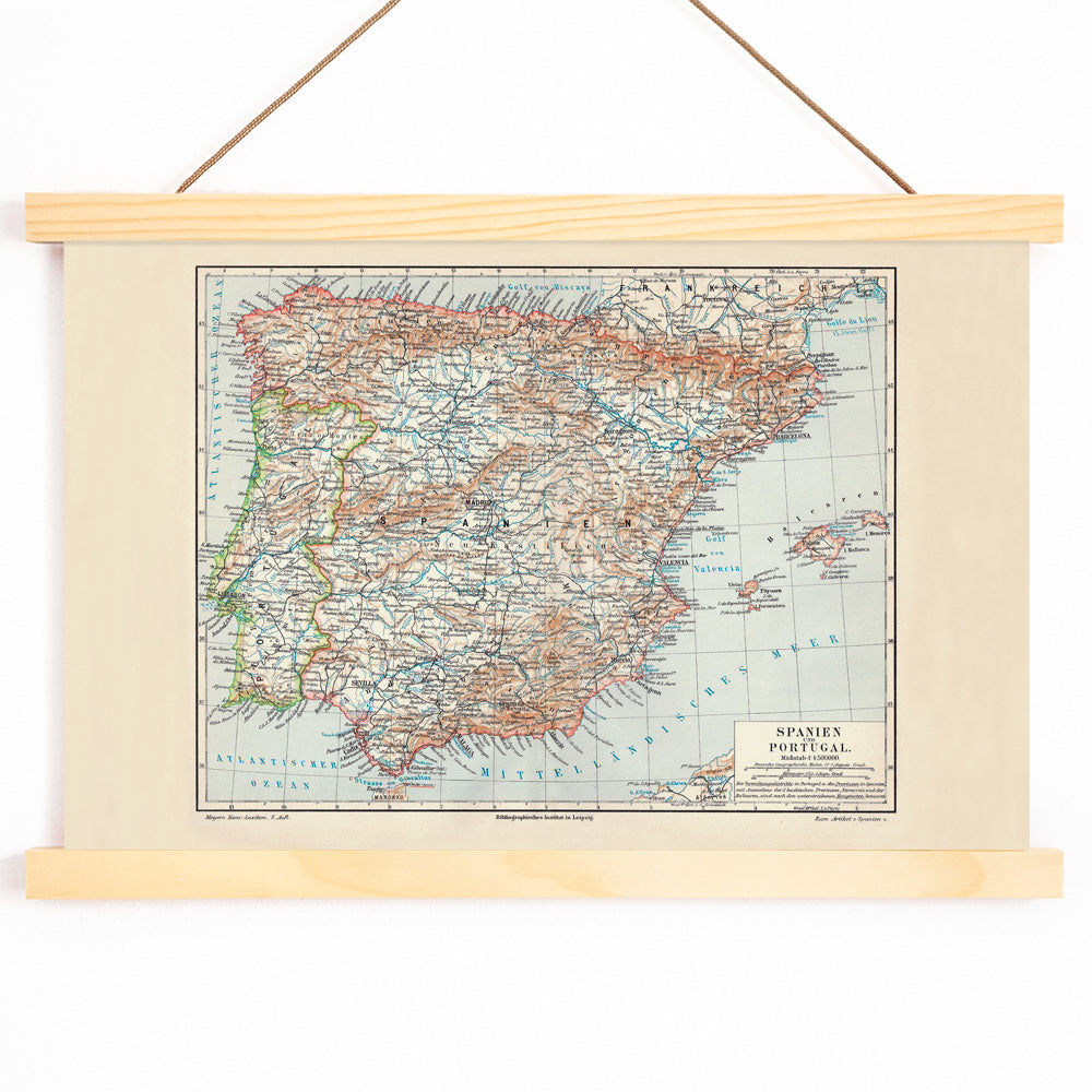
Carl Diercke was a German geographer and cartographer whose innovations in educational mapping shaped how generations of students understood the world. His atlases, first published in the late nineteenth century, became a standard in schools across Europe, emphasizing clarity, accuracy, and accessibility. Diercke’s work reflects a period when maps were essential tools for teaching geography, history, and political change.
The Artwork
This 1905 map of the Iberian Peninsula was created as a reference tool for classrooms and libraries, supporting lessons in geography, history, and the evolving political landscape of Spain and Portugal. Produced in Leipzig during a time of modernization and standardization in education, it exemplifies the era’s commitment to precise, informative cartography. Such maps were widely used to help students and scholars visualize territorial divisions, trade routes, and national identities.
Style & Characteristics
The map features the distinct contours of Spain and Portugal, bordered by surrounding seas and clearly delineated internal regions. Fine linework and compact, legible typography fill the surface with detailed place names and administrative boundaries, characteristic of classic school atlas plates. The color palette combines aged beige paper tones with soft blue for the coastal waters, while darker inks and subtle brown accents highlight key features and borders. The overall effect is scholarly and archival, evoking a sense of quiet nostalgia.
In Interior Design
This vintage map print brings a sense of history and sophistication to studies, libraries, entryways, or living rooms. It pairs well with natural wood, black metal, or linen textures, and complements both traditional and minimalist interiors. For a curated gallery wall, consider displaying it alongside other vintage map prints, or coordinate with beige wall art and understated blue accents. Framed, it offers a timeless decorative touch with an archival presence.